False Creek Oyster Survey #6
David Lam Park West and Around the Corner
Text and photos by Janet Snell
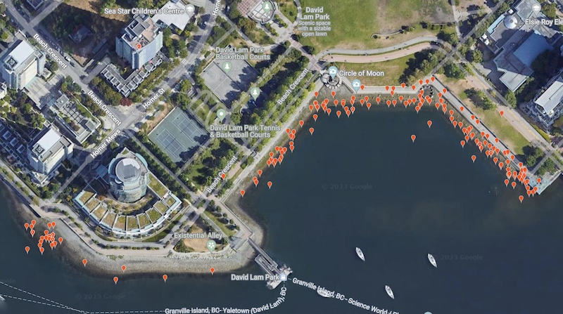
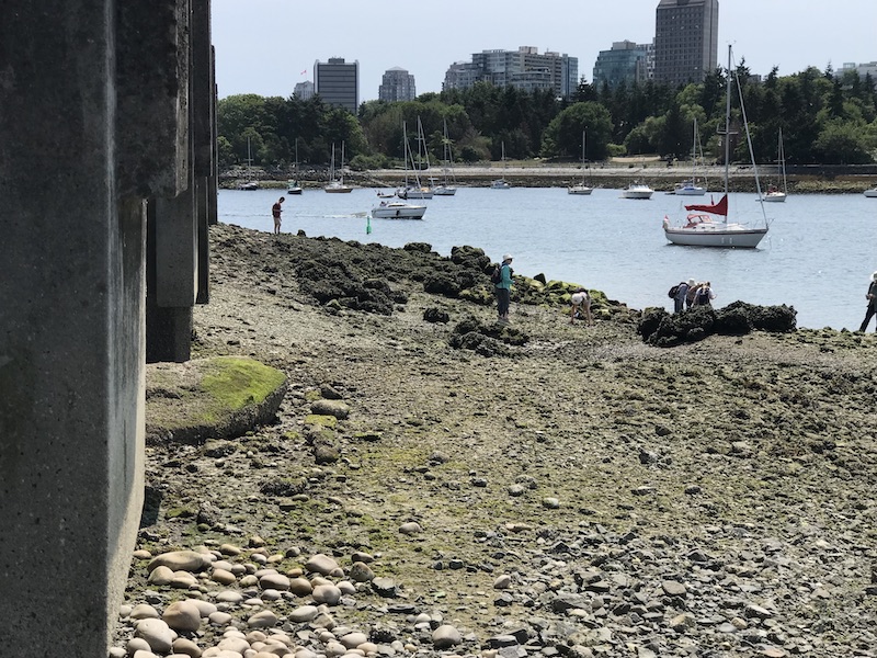
On a sunny Monday, July 3rd, another iNaturalist oyster survey was carried out at David Lam Park (West) with nine volunteers. We were continuing the survey begun two weeks earlier and continued west along the rocky shoreline of the park. The beach at the innermost location is composed of large and small cobbles at a shallow slope which flattens out at the lowest inter-tidal level where a wide strip of Pacific oysters was found. Interestingly, the oysters were distributed below and then scattered above, the wide band of Blue mussels covering the rocks. It seems that the mussels outcompete the oysters in the rocky housing market.
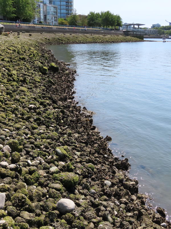
The beach was interrupted by concrete retaining walls surrounding what looks like a stormwater pipe outlet. We wondered if the freshwater outflow is a contributing factor in the abundant oyster growth at this beach. As this is a very dry time of year, there was no water visibly flowing out but in the rainy months, the flowing stormwater could alter the salinity of the water to a level that oysters prefer. Oysters are frequently found in estuaries where rivers of freshwater mingle with seawater into a briny mixture.
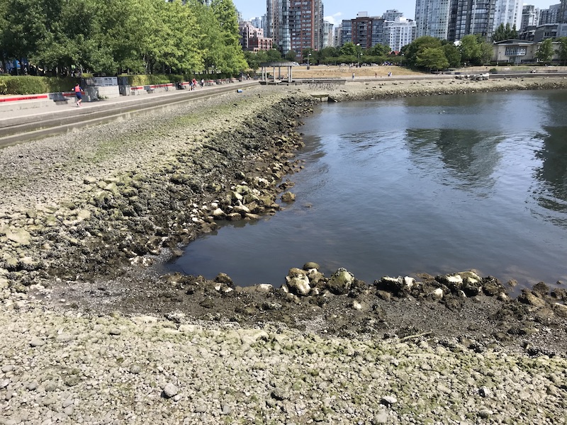
At this point, the shoreline extended to the southwest and further into False Creek. The rock size increased to boulder size and fewer oysters were visible. This is like other boulder covered shorelines that we have surveyed elsewhere. Yet, even at the end of the bay, where the shoreline flattens out near the ferry dock, there were few oysters. Is this due to, in this case, the absence of a freshwater source nearby?
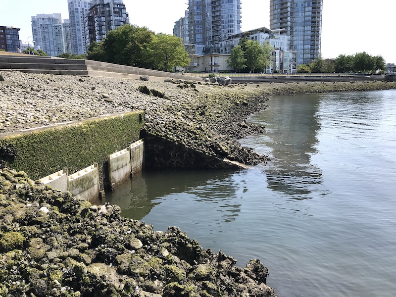
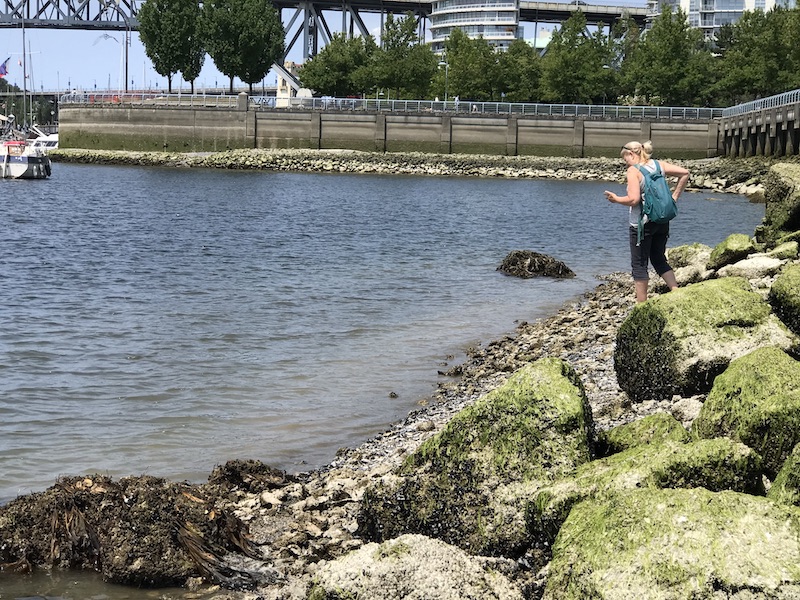
As we surveyed west from the ferry dock, the beach slope increased again with abundant boulders. We continued west to a very interesting area where the beach flattened out and appeared to be in a kind of sandy/gravelled valley between two boulder covered areas. The remnants of a water-stained beach ‘stream’ showed a pathway from under the seawall walkway above. Several pipes protruded from the seawall, indicating another stormwater source. As I followed this dried up ‘stream’ valley to the shore, a large flat and very dense oyster bed was visible.

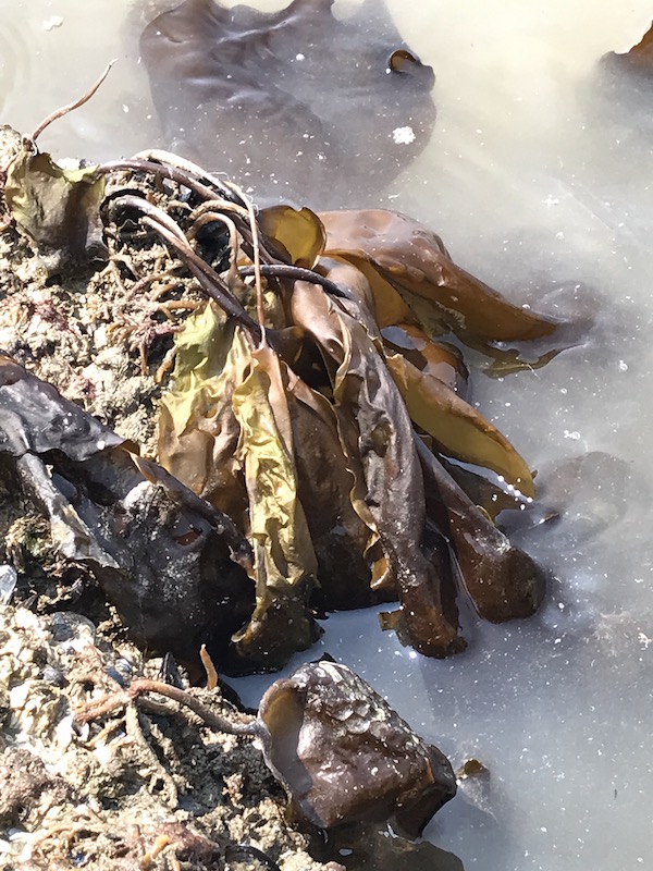
As we photographed and documented this exciting find, one of our marine biologists, Joan Lopez, noticed something else that was really interesting and that she was surprised to see in False Creek. A brown frilly ‘seaweed’ or more correctly, brown algae, called Sea Belt (Saccarhina latissimi) was located on large boulders deeper in the water on either side of the oyster bed. According to iNaturalist, Sea Belt helps to create biodiversity in the marine environment, as it acts like a marine forest in providing shelter and food for many other species. This is another indication that there is more life in False Creek than many people have expected to see.
It was another very satisfying day of observations. We feel like we are starting to see how pieces of the puzzle are linking together or are at least related. Beach substrate, slope, presence of freshwater, presence and influence of other species; we are seeing patterns that show us where the oysters prefer to live. Can we use this knowledge to encourage even more abundance in False Creek? Can we think about redesigning some of the shoreline areas that have very little marine ecosystem builders like oysters, mussels and marine forests into friendlier habitats that will encourage so many other forms of marine life.
A huge thank-you to the many volunteers who have been coming out, sometimes multiple times, to help us with this survey. This really is a project that wouldn’t exist without many hands on many cameras. Our next session will be on Sunday, July 16thwhen we start the more detailed Quadrat Survey at some of the oyster hotspot locations that we have surveyed. Please contact volunteer coordinator, Greg Leach at greg@naturevancouver.ca if you would like to join us.